


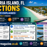







Anna Maria Island sits just off Florida’s Gulf Coast, close enough to three major airports that getting there is rarely the hard part of planning a trip. These Anna Maria Island FL directions cover every practical route, from the closest regional airport to a full interstate drive from Orlando, plus a current, dated update on bridge and road access since the island’s 2024 hurricanes. Whether you are flying in or driving the whole way, this guide has the exact route you need.
Table of Contents
Anna Maria Island FL Directions at a Glance
Anna Maria Island is a seven-mile barrier island on Florida’s Gulf Coast, roughly an hour south of Tampa and a twenty-minute drive due west of Bradenton. The island is made up of three connected cities, Anna Maria on the north end, Holmes Beach in the middle and Bradenton Beach to the south, all reached from the mainland by one of three bridges. No matter where your trip starts, these Anna Maria Island FL directions eventually funnel down to crossing one of those bridges onto the island itself.
Most visitors searching for Anna Maria Island FL directions fall into one of two groups. Some fly into a nearby airport and rent a car. Others drive the entire way from elsewhere in Florida or a neighboring state. Both paths are covered in detail below, along with the current bridge and road status every visitor should check before finalizing a trip.
Nearest airports to Anna Maria Island
| Airport | Distance | Drive time | Best for |
| Sarasota-Bradenton International (SRQ) | About 14 to 20 miles | 25 to 30 minutes | Shortest drive, growing airline options |
| Tampa International (TPA) | About 45 miles | 45 to 60 minutes | Most flight options and often the cheapest fares |
| St. Pete-Clearwater International (PIE) | About 45 miles | About 60 minutes | Budget carriers like Allegiant and Sun Country |
Anna Maria Island FL Directions From Tampa International Airport
Tampa International is the most popular arrival point for these Anna Maria Island FL directions, since it offers the widest range of airlines and frequently the best fares even though it is not the closest option. From TPA, take I-275 South, then continue onto US-19 South before heading west on SR-64, crossing the Manatee Avenue Bridge directly onto the island. The drive is straightforward interstate and state highway driving, typically taking 45 minutes to an hour depending on traffic.
During peak season, roughly February through April, the Manatee Avenue Bridge can back up on weekend afternoons, so building in an extra 15 to 30 minutes is a smart buffer if you are arriving on a Friday or Saturday. These Anna Maria Island FL directions from Tampa hold up well year-round. That seasonal timing adjustment is worth remembering regardless of which route you take.
Anna Maria Island FL Directions From Sarasota-Bradenton Airport
For the shortest of all the common Anna Maria Island FL directions, Sarasota-Bradenton International Airport is the closest regional option, roughly 14 to 20 miles away depending on your final destination on the island. From SRQ, take US-41 North toward Conquistador Parkway, then turn onto SR-684, also known as Cortez Road, which carries you across the Cortez Bridge directly into Bradenton Beach on the island’s south end.
Travelers headed to Anna Maria on the island’s north end instead of Bradenton Beach sometimes prefer the more scenic route through St. Armand’s Circle and Longboat Key, crossing the Longboat Pass Bridge into the Coquina Beach area. It takes a few minutes longer but trades highway driving for a genuinely pretty coastal drive. Either version of these Anna Maria Island FL directions from Sarasota-Bradenton gets you there well within half an hour.
Anna Maria Island FL Directions From St. Pete-Clearwater Airport
St. Pete-Clearwater International is the budget-friendly option among these Anna Maria Island FL directions, popular with travelers flying Allegiant or Sun Country into a smaller, less crowded airport. From PIE, head south on I-275, crossing the Sunshine Skyway Bridge, which carries a small toll each way, then continue on US-19 South before turning west on SR-64 to cross the Manatee Avenue Bridge onto the island. The full drive typically takes about an hour, making these Anna Maria Island FL directions from PIE only slightly longer than the Tampa route despite starting from a different airport entirely.
Anna Maria Island FL Directions From Longboat Key and Lido Key
A lesser-known set of Anna Maria Island FL directions applies to travelers already staying in the Sarasota area, particularly around Lido Key or downtown Sarasota. From Bayfront Drive west of downtown Sarasota, the John Ringling Causeway leads into St. Armand’s Circle, where the first exit onto North Boulevard of the Presidents continues onto Gulf of Mexico Drive. Following that road north through Longboat Key eventually crosses the Longboat Pass Bridge directly into the Coquina Beach area of Anna Maria Island.
This route trades a few extra minutes for one of the more scenic drives in the region, passing beachfront homes and bay views the entire way, which makes it a popular choice for visitors who are not in a hurry.
Anna Maria Island FL Directions by Car From I-75
For anyone driving rather than flying, I-75 is the backbone of most Anna Maria Island FL directions from elsewhere in Florida or from out of state. These Anna Maria Island FL directions are the ones most road-trippers rely on, since I-75 runs the length of the state and connects easily to nearly every other major highway. Take Exit 220 for SR-64, then head west directly toward Bradenton and across the Manatee Avenue Bridge onto the island. This route works whether you are approaching from the north through Tampa, from the south through Sarasota and Fort Myers or coming down I-75 from Georgia, a popular route for visitors from the Atlanta area making the full drive south.
Anna Maria Island FL Directions From Orlando and Other Florida Cities
Day-trippers and vacationers extending a Central Florida trip often need Anna Maria Island FL directions starting from Orlando specifically. From Orlando, take FL-417 Toll South, then merge onto I-4 West for roughly 50 miles before continuing onto I-75 South. Take Exit 228 for I-275 North toward St. Petersburg, then Exit 2 for US-41 South, turning right onto SR-64 West, which leads directly to the island. The full drive runs a little over two hours, making Anna Maria Island a realistic day trip or weekend extension for Orlando-based travelers.
These Anna Maria Island FL directions from Orlando also work well as the tail end of a longer theme park trip, since many families extend a Walt Disney World or Universal Orlando vacation with a few beach days on the Gulf Coast. Keep a little cash or a transponder handy for the FL-417 toll section, since not every rental car comes equipped with an active toll pass.
Travelers coming from Jacksonville, Miami or other major Florida cities follow a similar pattern: get onto I-75 heading in the correct direction, then take Exit 220 for SR-64 West once you are level with Bradenton. From Jacksonville, that means roughly three hours heading south on I-75 or I-95 combined with I-4. From Miami, it means a longer stretch north on I-75 through Alligator Alley across the Everglades, a scenic but longer drive worth breaking up with a stop in Naples or Fort Myers.
Which Bridge Should You Take to Anna Maria Island
Understanding these three bridges is the single most useful piece of Anna Maria Island FL directions knowledge you can carry into any trip, since nearly every route above eventually funnels through one of them.
Anna Maria Island’s three bridges
| Bridge | Leads to | Best for |
| Manatee Avenue Bridge (SR-64) | Holmes Beach, middle of the island | Most common route from Tampa, PIE and I-75 |
| Cortez Bridge (SR-684) | Bradenton Beach, south end | Shortest route from Sarasota-Bradenton Airport |
| Longboat Pass Bridge | Coquina Beach, south tip | Scenic route through Longboat Key and St. Armand’s Circle |
The Manatee Avenue and Cortez bridges sit only about two miles apart, so for most of these Anna Maria Island FL directions it genuinely does not matter which one you choose unless your final destination sits closer to one end of the island than the other.
Anna Maria Island FL Directions Update: Current Road and Bridge Status
Any current set of Anna Maria Island FL directions should address a question many past visitors are specifically searching for: whether the island’s roads and bridges are fully accessible following Hurricane Helene and Hurricane Milton in September and October 2024. As of this writing, all three bridges, Manatee Avenue, Cortez and Longboat Pass, are fully open to vehicle, bike and pedestrian traffic, with essential roads and bridge debris cleared and repaired. Anna Maria Island Hurricane Recovery Timeline and Rebuild Updates.
Local reporting confirms that the vast majority of island businesses have reopened, though a small number of specific landmarks remain under longer-term reconstruction, most notably the historic Rod & Reel Pier and the Anna Maria City Pier walkway, both still being rebuilt as of this writing. None of that affects road or bridge access to the island itself. Because recovery status can continue to change, it is worth a quick check of current local advisories before your trip, particularly if you are visiting a specific business or landmark rather than just the beaches.
Getting Around Once You’re on the Island
Once these Anna Maria Island FL directions get you across a bridge, getting around the island itself is a different story entirely. The free Anna Maria Island Trolley loops the length of the island from Coquina Beach on the southern tip up to the City Pier, running frequently and air-conditioned, making it easy to skip parking entirely once you arrive. Biking is a popular option too, since the island is only seven miles long end to end. Golf cart rentals are widely available for a slower, more social way to get around.
Walking is genuinely realistic for anything within a single city on the island, whether that is Anna Maria, Holmes Beach or Bradenton Beach, though crossing between all three on foot is a longer undertaking best left to a bike or the trolley. Many visitors who arrive by following these Anna Maria Island FL directions choose to skip a rental car for the island portion of their trip entirely, parking once near their accommodation and relying on the trolley and their own two feet for the rest of the stay.
Common Mistakes When Following Anna Maria Island FL Directions
The most common mistake is not accounting for peak-season bridge traffic, particularly on the Manatee Avenue Bridge during February through April weekends, which can add real time to an otherwise short final stretch. A second common mistake is relying on outdated Anna Maria Island FL directions that predate current road conditions rather than confirming current status, especially for anyone who last visited before the 2024 hurricanes. A third is underestimating how walkable the island is once you arrive, renting a car for the whole trip when a bike or the free trolley would have been simpler and cheaper.
A fourth mistake worth flagging is trusting an older printed map or a bookmarked page rather than checking current, updated Anna Maria Island FL directions before a trip, since bridge names and exit numbers occasionally get resurfaced or renumbered during Florida Department of Transportation maintenance work. A quick check of a live mapping app alongside the route descriptions in this guide is the safest way to combine turn-by-turn accuracy with the bigger-picture context those apps often leave out, like which bridge actually leads to which part of the island.
Frequently Asked Questions
What airport is closest to Anna Maria Island?
Sarasota-Bradenton International Airport (SRQ) is the closest major airport for anyone following Anna Maria Island FL directions, roughly 14 to 20 miles away depending on your destination on the island, with a drive time of about 25 to 30 minutes.
How long does it take to drive to Anna Maria Island from Tampa?
Following the Anna Maria Island FL directions from Tampa International Airport typically takes 45 minutes to an hour, using I-275 South, US-19 South and SR-64 West across the Manatee Avenue Bridge.
Is there a toll on the way to Anna Maria Island?
Only if your route crosses the Sunshine Skyway Bridge, which carries a small toll each way and is most relevant for travelers coming from St. Pete-Clearwater Airport or driving from the St. Petersburg area.
Can you walk across the bridge to Anna Maria Island?
Yes, all three bridges, Manatee Avenue, Cortez and Longboat Pass, are open to pedestrian and bike traffic in addition to vehicles, though most visitors drive across given the distance involved.
Is Anna Maria Island open to visitors after the 2024 hurricanes?
Yes. All bridges and essential roads have been repaired and are fully open. The large majority of island businesses have reopened. A small number of specific landmarks, including the Rod & Reel Pier, remain under longer-term reconstruction. This does not affect general access to the island.
Which bridge should I use to get to Anna Maria Island?
It depends mainly on your destination. Among all the Anna Maria Island FL directions in this guide, the Manatee Avenue Bridge is the most common route from Tampa, St. Pete-Clearwater and I-75, while the Cortez Bridge offers the shortest route from Sarasota-Bradenton Airport into Bradenton Beach.
Final Thoughts
These Anna Maria Island FL directions boil down to the same basic shape no matter where your trip starts: get to one of three nearby airports or take I-75 to Exit 220, then cross one of three bridges onto the island itself. All routes and bridges are fully open as of this writing, following the island’s recovery from its 2024 hurricanes. Once you arrive, the free trolley or a rental bike will handle the rest. Double check current conditions before you go. Share this guide with anyone still mapping out their first trip to Anna Maria Island.

The Maple Star Magazine editorial team is responsible for the accuracy, structure, and publishing standards that every article on this site is held to. This includes verifying sources before publication, maintaining consistency across our Travel, Technology, Lifestyle and revisiting published guides as facts, pricing, or industry standards change. Content published under this byline reflects collaborative editorial work rather than a single author's individual reporting.